
Introduction
Drainage for master developments in Singapore is the engineered management of storm water from the moment rain hits the ground surface through to its discharge at a public drain, canal, or reservoir outfall. It encompasses everything from gully inlets and underground pipes within individual plots to the major open drains, detention ponds, and floodways that protect entire townships from inundation. This article covers drainage planning, surface runoff management, ABC Waters integration, and PUB Code of Practice clearances for master developments – the complete technical and regulatory picture that master developers, civil and infrastructure engineers, and planning consultants need when delivering business parks, townships, mixed-use districts, and large industrial estates.
To obtain PUB drainage approval for a master development, a developer must align the site layout with drainage reserves and existing public drain corridors, design drainage systems to meet the prescribed design storm return periods and a maximum runoff coefficient (C ≤ 0.55 for sites ≥ 0.2 ha), integrate ABC Waters features for stormwater treatment and amenity, and submit all plans and hydraulic calculations via CORENET X with qualified person and Professional Engineer endorsements at each statutory gateway – from Development Control through to Certificate of Statutory Completion.
This article covers surface drainage, minor and major drainage systems, detention and retention strategies, integration with sewerage systems and utility diversions, and the full statutory submission workflow. Detailed hydraulic calculations are referenced throughout but not fully derived; the focus is on design strategy, regulatory navigation, and practical decision-making. Drainage is the natural or artificial removal of surface and subsurface water, and in the context of master developments, getting it right determines flood resilience, asset protection, land value, and long-term public health outcomes.
Key takeaways you will gain from this article:
-
How to structure a drainage masterplan that meets PUB’s Code of Practice on Surface Water Drainage (Seventh Edition, December 2018, with Addendum 3, April 2025).
-
How ABC Waters requirements influence platform levels, catchment subdivision, and land use planning across your development.
-
How to handle drainage and sewer utility diversions early to avoid costly rework during detailed design.
-
What drawings, models, and submission deliverables must be prepared for PUB and related agencies.
-
How experienced consultancies support developers in obtaining PUB clearances and designing for approval from day one.
Understanding Drainage in Master Developments
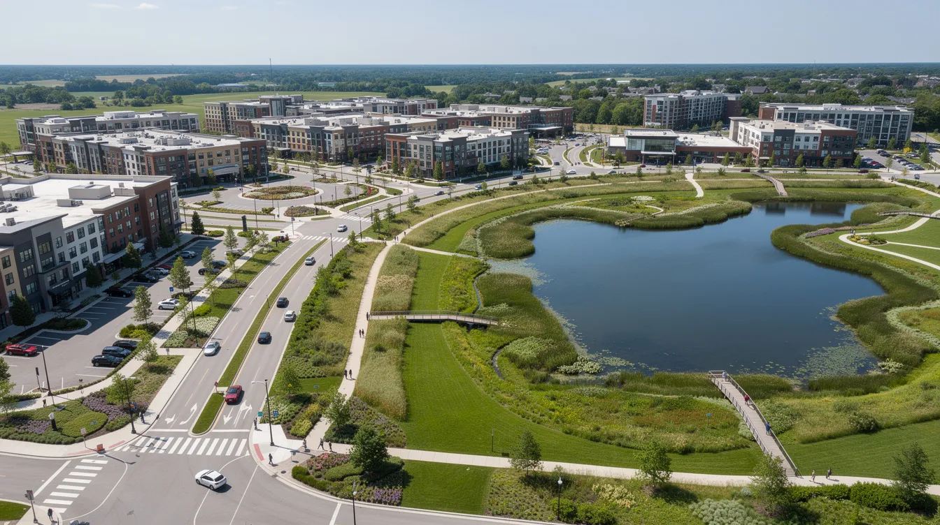
Drainage in a master development context refers to the end-to-end system managing stormwater from rainfall to outfall, spanning both minor systems (internal pipe networks, street drains, gully inlets) and major systems (canals, open channels, floodways). Drainage systems are engineered networks designed to remove excess surface water and groundwater, ensuring that developments remain functional, safe, and compliant across their design life. Good drainage prevents flooding and protects foundations from water damage – a principle that scales dramatically when applied to developments covering tens or hundreds of hectares.
For large projects in Singapore and the wider region, adequate drainage is directly linked to flood resilience, asset protection, urban design quality, and land value. Surface drainage systems manage water above the ground, while subsurface drains – also known as French drains – handle groundwater and seepage beneath platforms and structures. Together, these systems control water flow, preventing standing water accumulation that can compromise structural stability, damage buildings, and create public health hazards. Drainage helps maintain the longevity of structural elements in construction, from road pavements and service corridors to basement walls and retaining structures.
In this article, “drainage” includes open drains, culverts, roadside drains, internal pipe networks, detention and retention features (ponds, tanks, bioswales), connections to the public sewerage system, and outfalls to water bodies such as reservoirs, rivers, and the sea. It also encompasses the management of excess water during construction and the permanent infrastructure that channels storm water safely through urban areas.
Key Components of Urban Drainage Systems
A master development’s storm water drainage system comprises several interdependent layers. Understanding each component is essential for designing a coherent, approvable system:
-
Internal minor drainage network: Gully inlets, sump pits, pipe drains, and gratings within individual plots and streets that collect rainwater from roofs, courtyards, and paved surfaces. These are typically the first defence against stormwater saturation – functioning much like downspouts and gutters at the building scale – and are sized for lower return period storms (commonly 10-year events for catchments under 100 ha).
-
Major drainage routes: Roadside drains, engineered swales, open channels, and floodways designed for higher return periods (25-year to 50-year storms depending on catchment size). These provide the primary conveyance backbone, with freeboard, redundancy, and safe overtopping paths to handle extreme rainfall without catastrophic failure.
-
Detention and retention elements: Detention ponds store stormwater temporarily and release it slowly to mitigate flooding downstream. Other elements include underground detention tanks, rooftop and podium-level detention, rain gardens, and bioswales compliant with ABC Waters certification requirements. These features are central to meeting PUB’s discharge limits.
-
Outfalls and interface points: Site drains, channels, and outfalls must be connected to existing PUB drains, canals, or approved receiving systems with verified levels and capacity. Design must verify invert levels, alignment, and downstream capacity based on the outfall location and site conditions to ensure no adverse upstream or downstream flooding, no siltation, and maintained water quality – especially where discharge enters reservoirs.
-
Supporting geotechnical and structural elements:Earth retaining structures, culverts, embankments, retaining walls, and erosion control structures that maintain drainage channel integrity and prevent soil erosion around buildings. Geotextiles retain fine soil particles while allowing water to pass, preventing soil clogging in drainage systems.
Regulatory Context: PUB Codes, Sewerage and Drainage Act, ABC Waters, and Related Guidelines
The regulatory framework governing drainage in Singapore is comprehensive and multi-layered. Civil engineers manage drainage in construction projects; they set levels for roads, gutters, and sewers – and for master developments, these levels must align precisely with PUB’s requirements.
PUB’s core regulatory instruments include:
-
Code of Practice on Surface Water Drainage (Seventh Edition, December 2018, with Addendum 3, April 2025): The definitive technical and submission framework for planning, designing, and constructing drainage infrastructure across Singapore. It specifies design storms, minimum platform levels, discharge limits, drainage reserve requirements, and Earth Control Measures during construction.
-
ABC Waters Design Guidelines (5th Edition, 21 June 2024): Detailed design parameters for integrating stormwater quality treatment, biodiversity, and public amenity into drainage infrastructure. Certification requires a minimum score of 45 points (Certified) or 65 points (Certified Gold), with treatment needed on at least 40% of site area for Gold certification.
-
Guidelines on Earth Control Measures (ECM): Mandatory plans for managing erosion, sediment runoff, and temporary drainage during construction. The qualified person must submit ECM plans, and contractors must implement best practices with regular monitoring.
-
Code of Practice on Coastal Protection (introduced 17 June 2026): PUB’s newest code, complementing the surface drainage COP with requirements on coastal protection levels and design standards adapted to future climate projections, particularly sea-level rise. For low-lying master developments near the coast, this directly intersects with drainage design through platform, crest, and reclamation level requirements.
Several related agencies also shape drainage outcomes. URA planning parameters – plot ratios, building heights, setback requirements – influence catchment characteristics and runoff patterns. LTA road levels and cross-sections affect roadside drainage, culvert sizing, and camber design. NParks requirements apply where drains pass through park connectors or green corridors. SCDF mandates that access points and fire appliance staging areas remain flood-free. Drainage laws govern landowner alterations to drainage systems, and the sewerage and drainage act establishes the legal framework under which PUB exercises regulatory authority over both drainage and sewerage works.
Master developers should treat these codes and guidelines as design inputs from the concept stage – not as compliance checks applied retrospectively at the end. Early integration avoids costly redesign and accelerates the authority approval process.
Types of Drainage Solutions for Large-Scale Developments
Master planning requires selecting and combining different drainage typologies based on topography, soil conditions, land use mix, and regulatory targets. Effective drainage systems often combine multiple approaches to manage water flow – no single solution addresses the full range of design storms, water quality requirements, and spatial constraints encountered in townships, industrial parks, and mixed-use precincts. Soil composition and land slopes help water drain naturally, but engineered systems are always required in Singapore’s dense urban areas to provide reliable, code-compliant performance.
Surface Drainage Systems: Open Drains, Roadside Drains, and Channels
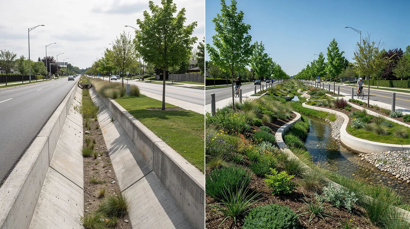
Surface drainage systems include open drains and grassed waterways. Surface drains redirect standing water away from areas susceptible to waterlogging. For master developments, surface conveyance is preferred when designing major drainage routes because it allows easier inspection, lower construction costs for large catchments, and direct integration with ABC Waters features.
Common forms used in Singapore include:
-
Rectangular and trapezoidal open drains lining internal roads, typically constructed in reinforced concrete with specified minimum gradients to avoid ponding.
-
Covered roadside drains with removable slabs providing maintenance access while protecting pedestrians.
-
Grassed swales and vegetated channels – swales are shallow channels designed to convey and infiltrate water, serving both conveyance and treatment functions for ABC Waters compliance.
-
Ditches and lined channels for industrial estates where robustness and easy desilting are priorities.
Key design considerations include hydraulic capacity based on design storms (e.g. 50-year return period for major system elements in catchments above 1,000 ha), minimum gradients to prevent ponding and sedimentation, maintenance access, safety measures such as fencing and covers, and aesthetics. Proper drainage reduces soil erosion around buildings and prevents the washing away of topsoil that maintains landscaping stability. The environmental impact of surface drainage design extends to water quality in downstream water bodies, making material selection and channel lining important decisions.
Subsurface Drainage and Platform Level Management
Subsurface drainage in the master development context refers to subsurface drains behind earth retaining structures, beneath raised platforms, and under landscaped areas, with the type and arrangement depending on the location of the drain, including local groundwater conditions, adjacent structures, and platform geometry. These systems control groundwater, perched water tables, and seepage that can compromise structural stability and cause long-term settlement.
Subsurface drainage is critical in several scenarios:
-
Basement developments near canals or reservoirs: Where hydrostatic pressures require dewatering and permanent subsoil drainage to prevent uplift and water ingress.
-
Retaining walls for elevated road platforms: Where weep holes, geocomposite drains, and collector pipes manage hydrostatic pressure behind the wall.
-
Land reclamation or coastal brownfield redevelopment: Where the water table is high and soils may have variable permeability, requiring comprehensive ground investigation and drainage design.
Geotextiles play a critical role in these systems, preventing fine soil particles from clogging drainage pipes while allowing water to pass freely. The link to geotechnical engineering is direct: subsurface drainage affects stability, uplift resistance, and long-term settlement performance of the entire development platform. Water pooling near foundations can cause structural issues ranging from differential settlement to basement flooding.
Integrated ABC Waters Features: Detention, Treatment, and Amenity
The ABC Waters programme – “Active, Beautiful, Clean” – requires master developments to combine stormwater quantity control, quality treatment, and public amenity in a single integrated design. This goes well beyond conventional drainage: it transforms functional infrastructure into landscape assets that enhance user experience and biodiversity.
Typical ABC Waters elements suitable for master developments include:
-
Detention ponds and wet ponds integrated with parks or town plazas, providing visible water features while attenuating peak flows.
-
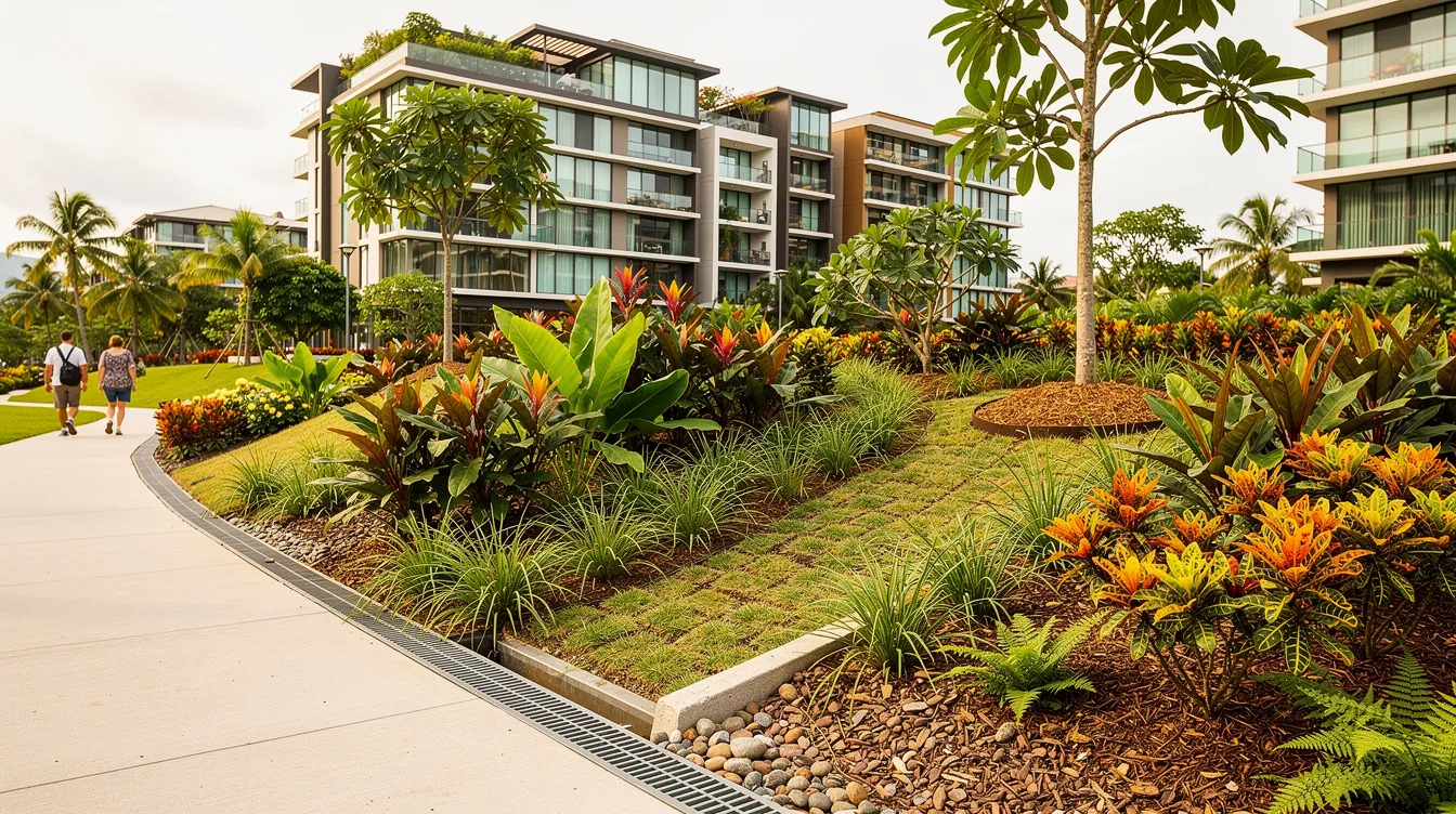
Bioswales and bioretention rain gardens along streets, within car parks, and alongside building frontages – engineered soil media systems that filter pollutants (total suspended solids, nutrients) while slowing runoff.
-
Green roofs and podium-level detention for commercial or community buildings, reducing impervious surface area and providing thermal benefits.
-
Permeable pavements and tree pits with engineered substrates that infiltrate rainwater at source, reducing the volume entering the pipe network.
These features reduce peak discharge to the public sewer and drain network, improve water quality before discharge into rivers and reservoirs, and create active public spaces. For developments targeting ABC Waters Gold certification, treatment must cover at least 40% of the site area. The Water Sensitive Urban Design (WSUD) approach provides the broader framework within which ABC Waters features operate.
Detention ponds store stormwater temporarily and release it slowly to mitigate flooding – a principle that PUB enforces through its requirement that developments ≥ 0.2 ha limit peak discharge to an equivalent runoff coefficient of C = 0.55, with the balance detained on-site.
Drainage and Sewer Utility Diversions in Brownfield Sites
Existing drains and sewers frequently need to be diverted when land use is intensified or parcels are reconfigured in brownfield redevelopments. Legacy infrastructure – old public sewer lines, roadside drains within new building footprints, drain alignments conflicting with new MRT station entrances or access roads – presents some of the most complex coordination challenges in master development drainage.
Typical diversion scenarios include:
-
Existing roadside drains falling within new building footprints, requiring relocation to new road corridors.
-
Old sewers crossing proposed basement excavation zones, necessitating diversion before piling can commence.
-
Drain alignment conflicts with new access roads, pedestrian malls, or transit infrastructure.
Early coordination with PUB (both drainage and sewerage departments), BCA, LTA, and utility owners is essential. Condition surveys of existing assets – CCTV inspection, structural assessment, trial hole investigations – must be completed before finalising plot boundaries or basement extents. Failure to identify and plan for diversions early is one of the most common causes of programme delays and cost overruns in master development projects. The potential impact of delayed diversions ripples through construction sequencing, temporary works design, and regulatory approval timelines.
Designing a Drainage Masterplan: From Concept to Detailed Design
Having understood the range of system types and ABC Waters options available, the next challenge is structuring a coherent drainage masterplan that PUB and other agencies can review and approve. This process demands early multidisciplinary coordination across civil, geotechnical, architectural, M&E, and landscape disciplines. Hollow-pipe drainage was invented by Sir Hugh Dalrymple in 1753 – but modern drainage master planning for Singapore’s dense developments requires a precision and regulatory sophistication that would be unrecognisable to early innovators.
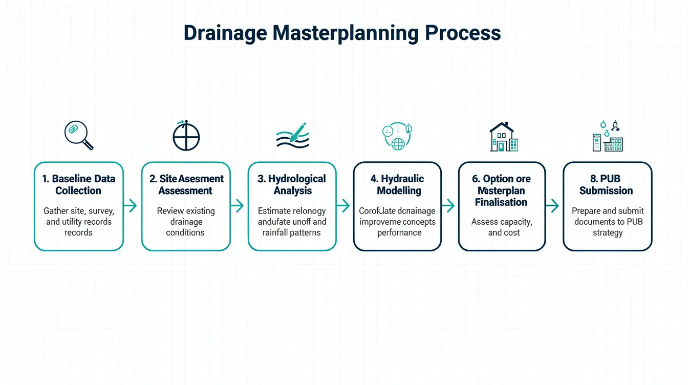
Step-by-Step Drainage Master Planning Process
The following process outlines how a drainage masterplan progresses from baseline data collection to submission-ready documentation:
-
Collect baseline data: Obtain existing drainage plans from PUB (Drainage Interpretation Plan, Sewerage Information Plan, Water Service Plan), site survey levels, soil investigation results, flood history, and URA/LTA gazetted road levels. Identify all existing public drains, sewers, and drainage reserves traversing or adjacent to the site.
-
Define design storms and performance criteria: Establish minor and major system return periods based on catchment size – 10-year for catchments under 100 ha, 25-year for 100–1,000 ha, and 50-year for catchments exceeding 1,000 ha. Set allowable discharge at each outfall and define ABC Waters treatment targets.
-
Develop overall grading and platform level strategy: Establish minimum platform levels (MPLs) – Northern Coast sites require 4.5 m above Singapore Height Datum, Southern Coast sites 4.0 m, with additional clearances above adjacent road or ground levels (300 mm for general development, 600 mm for industrial/commercial/multi-unit residential, 1 m for special facilities). Set crest levels at basement entrances (150 mm above MPL for general, 300 mm for industrial/commercial and special facilities).
-
Subdivide catchments and select conveyance routes: Identify subcatchment boundaries, primary drain corridors, redundancy paths, and emergency overflow routes. Singapore’s drainage network spans approximately 8,000 km of drains, canals, and rivers collecting runoff into 17 reservoirs – master developments must integrate seamlessly into this system.
-
Size key infrastructure: Design main open drains, culverts, detention volumes, and critical pipes using preliminary hydraulic calculations. For developments ≥ 0.2 ha, ensure total site discharge does not exceed the equivalent of a runoff coefficient of C = 0.55, with the balance detained on-site via detention tanks or storage systems.
-
Integrate ABC Waters and landscape: Coordinate with landscape architects to transform functional drainage into amenity features – bioretention gardens, wet ponds, permeable pavements – meeting certification score requirements.
-
Coordinate with utilities and structures: Ensure drains and sewers clear building foundations, MRT protection zones, pumping stations, and other services. Plan diversions of existing infrastructure early.
-
Prepare submission-ready models and drawings: Produce plans, sections, long-sections, hydraulic summaries, and 3D visualisations ready for submission through CORENET X.
Key Design Calculations and Modelling Considerations
The key calculations underpinning a drainage masterplan include:
-
Runoff estimation: For small sub-catchments (under 100 ha), the Rational Method is commonly used; for larger basins, full hydrological modelling with PUB’s published Intensity-Duration-Frequency (IDF) curves, composite land use coefficients, and time of concentration analysis. Tools typically used include InfoWorks ICM, MIKE URBAN, SWMM, and specialist spreadsheets for detention sizing.
-
Pipe and channel sizing: Based on design discharge, allowable velocities (maintaining self-cleansing velocity to prevent sedimentation while avoiding scour), freeboard requirements, and gradient constraints. Invert levels must align to enable gravity flow throughout the system, except where pumping is necessary.
-
Detention volume sizing: PUB’s On-site Stormwater Detention Tank Systems Technical Guide governs design. Two types exist – online (all flow passes through the tank) and offline (excess flow diverted via side weirs). Both must empty within 4 hours after a storm event. For combined stormwater detention and rainwater harvesting, detention volumes must be independent of harvesting volumes; harvesting cannot reduce required detention storage capacity.
-
ABC Waters feature sizing: Treatment volume and media depth calculations, hydraulic conductivity of engineered soil media, planting specifications, and maintenance access requirements per the 5th Edition ABC Waters Design Guidelines.
Integrating Drainage with Roads, Plots, and Public Spaces
Drainage must align precisely with the development’s road cross-sections, plot access points, and public spaces. Key integration considerations include:
-
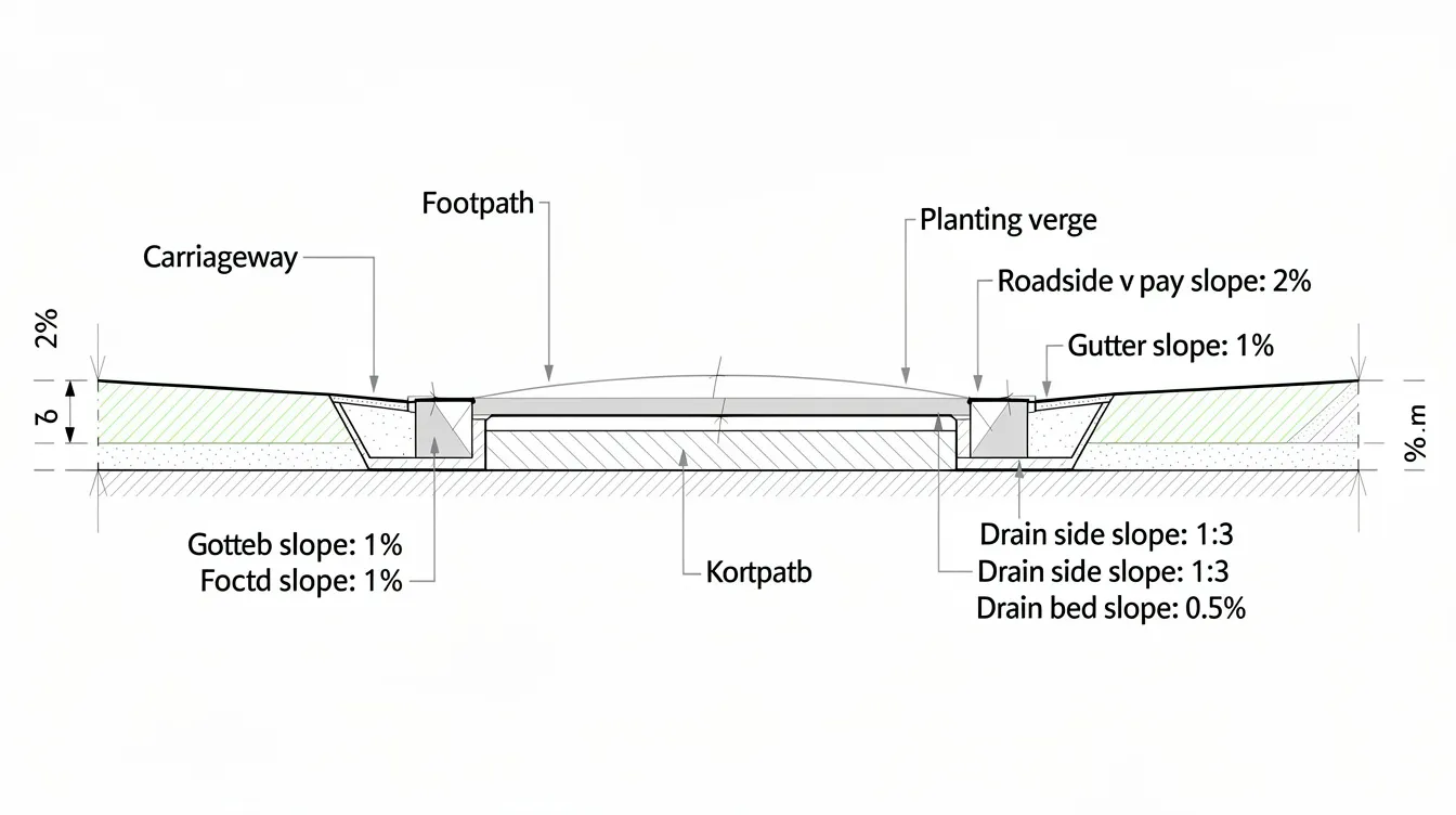
Road cross-sections: Carriageway camber, kerb heights, gully inlet placement, and sag point management. Every road must shed water to its drainage system without ponding – and road levels must coordinate with adjacent plot platform levels.
-
Plot access and thresholds: Building entrances, basement ramp entrances, and loading bay thresholds must sit above the defined crest levels to prevent flood water flowing into buildings. This is especially critical for facilities housing electrical substations, data centres, hospitals, and other critical infrastructure.
-
Public spaces: Plazas, parks, waterfront promenades, and transit interchanges must integrate drainage seamlessly. Detention features can be designed beneath public plazas; bioretention planters can line pedestrian routes; and permeable pavements can reduce runoff from open spaces while maintaining accessibility.
-
Flood-free access routes: Key facilities – including SCDF fire appliance access, ambulance routes, and power supply buildings – must have verified flood-free access under design storm conditions. Grading strategies should create positive fall away from these facilities toward the nearest drain or detention feature.
Obtaining PUB Drainage and Sewer Diversion Clearances
Technical design excellence is necessary but insufficient – it must be translated into a compliant submission package that PUB can review, audit, and approve. Understanding the process, documentation requirements, and evaluation criteria is essential because timelines for PUB clearance can significantly affect project viability and construction sequencing.
Typical Submission Workflow and Documentation
The statutory submission process for drainage in a master development follows these stages:
-
Pre-consultation with PUB: Discuss concept drainage strategy, proposed outfall locations, drainage reserve requirements, ABC Waters approach, and any sewer or drain diversions. A site plan overlaid with PUB Services Plans (Drainage Interpretation Plan, Sewerage Information Plan, Water Service Plan) is required to identify constraints early.
-
Development Control (DC) submission: Submit via CORENET X Design Gateway (G1) with PUB-DCCLR (“No Objection”) forms covering the drainage masterplan, catchment plans, schematic sections, and runoff/discharge summaries with intended ABC Waters features.
-
Detailed Plan (DP) submission: Detailed layout plans, longitudinal profiles, structural details, full hydraulic calculations, construction sequencing, and ECM measures, submitted with PUB-DPCLR documentation and PE endorsement.
-
Coordination with other agencies: URA, LTA, NParks, and SCDF where their comments impact drainage design – for example, building setback requirements affecting drain corridors, or LTA road design affecting culvert sizing.
-
Construction clearance and supervision: Site checks, PE inspections, ECM compliance monitoring, and PUB-DRATOP forms for Temporary Occupation Permit clearance.
-
As-built submissions and handover: PUB DD-CSIDRA forms for Certificate of Statutory Completion, as-constructed drainage drawings, and handover documentation for any infrastructure to be adopted as public assets.
Typical drawing deliverables include drainage masterplans, catchment plans, longitudinal sections with invert levels, pipe schedules, manhole schedules, detention tank details, diversion plans, and drainage design submission packages.
Key Evaluation Criteria Used by PUB
PUB evaluates drainage submissions against several critical criteria:
|
Criterion |
What PUB Examines |
|---|---|
|
Platform and crest levels |
Compliance with MPLs and crest levels at all building entrances, basement openings, and critical thresholds |
|
Discharge compliance |
Conformance to allowable discharge at outfalls (C ≤ 0.55 for sites ≥ 0.2 ha) with no adverse impact on upstream or downstream flooding |
|
Drain capacity |
Adequacy of drain capacity and freeboard under design storms, including blockage allowances |
|
Emergency overflow |
Robustness of emergency overflow paths and major drainage routes under extreme events |
|
ABC Waters features |
Quality, maintainability, and treatment performance of ABC Waters features – media specification, planting, access for maintenance |
|
Water quality protection |
Protection of water quality at discharge points, especially where outfalls connect to reservoirs or waterways – preventing contamination and untreated sewage from entering water bodies |
An experienced consultancy anticipates these criteria and “designs for approval” from the outset – embedding regulatory requirements into the concept design rather than retrofitting compliance during detailed design. This approach avoids abortive work and reduces the risk of conditional approvals that delay construction commencement.
Drainage and Sewer Utility Diversion Clearances
When existing drains or sewers must be diverted, additional process steps apply:
-
Condition surveys: CCTV inspection and structural assessment of existing assets to determine their condition, material, and capacity before designing replacement alignments.
-
Staged diversion planning: Maintain service continuity throughout construction – untreated sewage and wastewater must never be discharged uncontrolled during diversion works. Temporary bypass systems, sacrificial drains, and phased cut-over sequences are standard engineering works.
-
Agreement with PUB: New alignments and capacities must be agreed with PUB’s Sewerage Department and Drainage Department. The qualified person must certify that diverted infrastructure meets or exceeds original performance.
-
Temporary works design: Excavation support, shoring, traffic management, and protection of adjacent services – areas where PE endorsement and specialist coordination are essential.
Common Challenges and Environmental Impact in Drainage Planning and How to Address Them
Master developments in dense urban settings face complex constraints: limited level fall across flat sites, legacy utilities crossing key plots, tight construction programmes, and increasingly intense rainfall driven by climate change. Drainage is important for maintaining the longevity of structural elements in construction, so getting these challenges right has lasting consequences. Waterlogged soil diminishes plant health and contributes to root rot – a concern not just for agriculture but for the extensive landscaping that characterises modern developments.
Limited Level Difference and Flat Sites
Many Singapore sites – particularly those on reclaimed land or in low-lying coastal zones – have minimal gradient across the site. This creates challenges for gravity-driven drainage: insufficient slope for pipes leads to sedimentation, and raising platform levels to meet MPL requirements can trigger substantial earthworks costs.
Solutions include:
-
Strategic earthworks and platform level zoning established early in the masterplan, creating controlled level differences that enable gravity drainage across the site.
-
Shallow, wide surface channels and swales instead of deep pipes – reducing excavation depth while maintaining adequate drainage capacity. These can double as ABC Waters features.
-
Localised pumping stations for basement drainage where gravity discharge to public drains or the sea is not feasible, with backup power and redundancy to maintain service during outages.
Existing Drains, Sewers, and Utilities Crossing Key Plots
Legacy infrastructure constraining building footprints and road layouts is one of the most common sources of redesign on brownfield sites. Existing public sewer lines, drains running through proposed building zones, and underground pipes in unexpected locations can derail construction programmes if discovered late.
Solutions include:
-
Early utility mapping – trial trenches, utility detection surveys, and ground-penetrating radar – before finalising plot boundaries. Reviewing the Sewerage Interpretation Plan and Drainage Interpretation Plan with PUB at pre-consultation stage is critical.
-
Bundling diversions with major road or streetscape improvement works to optimise phasing and reduce disruption.
-
Adopting building layouts that straddle or bridge over drains where permitted and technically feasible, with appropriate structural design to maintain drain access for maintenance.
Meeting ABC Waters Objectives Without Sacrificing Yield
There is an inherent tension between maximising developable floor area and reserving land for ponds, bioswales, planted corridors, and detention features. The costs of dedicating prime land to drainage amenity must be weighed against the regulatory and placemaking benefits.
Mitigation measures include:
-
Multi-functional spaces: Detention under plazas, green roofs that reduce impervious area, and podium-level bioretention planters that serve both drainage and amenity functions without consuming ground-level plot area.
-
Integration with planning requirements: ABC Waters features can overlap with NParks green buffer requirements and URA communal open space provisions, reducing the net additional land take.
-
Distributed small-scale features instead of one large pond – bioretention bays distributed along road frontages, permeable paving in car parks, and tree pits with engineered media – fitting around buildings more flexibly and improving treatment coverage across the site.
The sustainable drainage systems approach provides additional design strategies for balancing yield with environmental performance.
Construction-Phase Flooding and Siltation
During construction, blocked drains from sediment, localised site flooding, and regulatory non-compliance are common issues that can attract enforcement action and delay occupation permits. Erosion prevents the washing away of topsoil and maintains landscaping stability – but during active earthworks, exposed soil is highly vulnerable.
Solutions include:
-
Developing and implementing Earth Control Measures plans aligned with PUB requirements – silt fences, sediment treatment ponds, regular desilting schedules, and monitoring after heavy rainfall events.
-
Temporary diversions and sacrificial drains to protect critical works areas and maintain flow through the broader drainage network.
-
Regular joint site inspections by contractor, Resident Engineer, and PE to assess ECM effectiveness and adjust measures after storms – ensuring that sediment-laden runoff does not reach public drains, rivers, or reservoirs.
Conclusion and Next Steps
Effective drainage planning for master developments demands the integration of three concurrent objectives: hydraulic performance ensuring no flooding under design storms, regulatory compliance with PUB’s Code of Practice and ABC Waters certification requirements, and urban design quality that turns drainage infrastructure into landscape amenity with long-term maintainability. These objectives are not in conflict – when coordinated from the concept stage through a structured masterplanning process, they reinforce each other and de-risk the development programme.
Singapore’s regulatory environment continues to evolve. The introduction of the Code of Practice on Coastal Protection in June 2026, updates to ABC Waters Design Guidelines, and the shift to digital submissions via CORENET X all demand that development teams stay current and coordinate closely across disciplines. Regular maintenance of drainage systems is crucial for their operational efficiency – and this must be factored into design decisions from the outset, not treated as an afterthought.
Practical next steps for developers and their engineering teams:
-
Audit current or planned masterplans against PUB drainage requirements and ABC Waters certification criteria.
-
Schedule an early-stage drainage and level-planning workshop bringing together civil, geotechnical, architectural, and landscape disciplines before plot boundaries are fixed.
-
Engage a qualified PE consultancy such as AEC Technical Advisory to review and optimise drainage strategies – and prepare submission-ready documentation – before statutory submissions commence.
-
Plan a site visit to successful ABC Waters and drainage implementations in Singapore to align stakeholders on design quality expectations.
-
Establish a utility mapping and diversion strategy as a priority workstream – not a downstream activity – to prevent programme delays.
Related topics worth exploring include flood risk assessments for climate adaptation, coastal protection strategies under PUB’s new CPCOP, and the intersection of sewer connection approvals with drainage masterplan design.
Additional Resources and Reference Materials
-
PUB Code of Practice on Surface Water Drainage (Seventh Edition, December 2018, with Addendum 3, April 2025) – core technical and submission requirements for all drainage engineering works in Singapore.
-
ABC Waters Design Guidelines (5th Edition, 21 June 2024) – detailed design parameters, treatment specifications, and case studies of certified ABC Waters projects.
-
PUB On-site Stormwater Detention Tank Systems Technical Guide – procedures for designing online and offline detention systems, including discharge methods and emptying time requirements.
-
CORENET X Submission Workflows – gateway-by-gateway guide to digital submission of drainage and sewerage works documentation.
-
URA and LTA technical handbooks on road design, platform levels, and setback requirements as they relate to drainage integration and plot-level grading.
-
PUB Earth Control Measures guidelines – requirements for erosion and sediment control during construction, including monitoring and reporting obligations.