
Building setback in Singapore is the mandatory distance between a building’s external wall and either the road reserve or a common boundary line, measured excluding any land that will be vested to the State. Residential road buffers typically run within a range depending on road category and building height, commercial buffers vary by road hierarchy, and common boundaries generally include a peripheral planting verge of minimum width. URA sets the baseline figures; PUB governs drainage reserve constraints that can override or complicate them, which is why every submission needs both checked before design locks in.
TL;DR:
- Confirm the road category and building height band using the latest LTA Road Interpretation Plan and URA’s setback tables before finalizing designs.
- Ensure a minimum 2-meter peripheral planting verge is maintained at common boundaries, scaled up for taller flats and condominiums, to meet URA requirements.
- Check drainage reserves and infrastructure constraints with PUB’s latest Service Plans early in the process to avoid costly layout modifications later.
- Respect site-specific setback modifications for conservation areas, urban design zones, or approved masterplans, and verify current rules instead of relying on previous project figures.
- Rely on a qualified person to cross-reference all agency requirements and obtain formal setback approvals before detailed design or construction to prevent costly violations.
Table of Contents
- What Counts as the Building Setback Measurement Baseline?
- How Wide Is the Common Boundary Setback and Planting Verge?
- What Are the Setback Rules for Different Building Types?
- Do Good Class Bungalow Areas Have Stricter Setbacks?
- How Do PUB Drainage Reserves Affect Setback Planning?
- What’s the Process for Confirming and Submitting Setback Compliance?
- Which Laws and Agencies Govern Setback Requirements?
- How Do You Get Setback Approval From URA and PUB?
- What Happens if a Building Violates Setback Rules?
- When Do Setback Rules Get Relaxed or Adjusted?
- Publisher Perspective: Treating Setbacks as a Design Driver, Not a Compliance Afterthought
- Get Setback and Drainage Confirmed Before You Design, Not After
- Where to Verify Current Setback Rules
- Sources
What Counts as the Building Setback Measurement Baseline?
Setback distance is measured from the road reserve boundary, or the common boundary shared with a neighboring lot, straight to the external face of the building. Land earmarked for future State acquisition, road widening reserves being a common example, is excluded from that measurement. That exclusion trips up more first-time applicants than any other rule on the books.
The road buffer is the total distance URA requires between the road reserve and the building line. It is not a single number. It bakes in a green buffer, a landscaped strip that must sit within that width, so the road buffer and the green buffer are not two separate distances stacked on top of each other. Confirming the correct figure means first confirming the road category, and that comes from the LTA Road Interpretation Plan (RIP), not from a site visit or an old plan pulled from a previous project.
Before finalizing any layout, a Qualified Person should verify:
- The road category assigned to the frontage on the current LTA RIP.
- Whether the site fronts more than one road, since corner lots often carry two different buffer requirements.
- Whether any part of the frontage falls within land already flagged for State vesting.
- The building height band, since taller schemes trigger larger buffers under URA’s flats and condominiums setback tables.
Getting the road category wrong at concept stage cascades into every drawing that follows. It is worth confirming twice.
How Wide Is the Common Boundary Setback and Planting Verge?
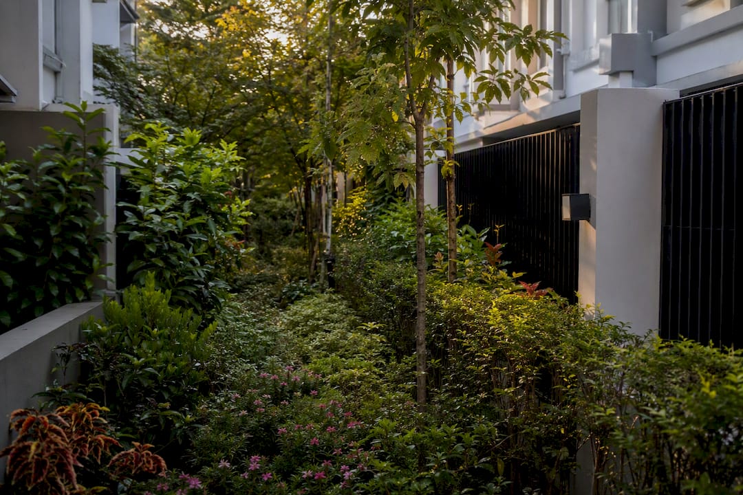
Every development in Singapore facing a common boundary, rather than a road, must generally leave a minimum 2m peripheral planting verge, measured from the boundary line inward. That strip cannot be swallowed by hardscape or building footprint. It exists for privacy screening and ventilation between neighboring plots, and URA checks it on plan before checks on almost anything else in a residential submission.
For flats and condominiums, common-boundary setbacks scale upward with storey height rather than staying fixed. A low-rise scheme of three or four storeys sits close to the 2m minimum, while a development climbing past ten storeys needs a noticeably wider gap, per URA’s residential setback tables.
A worked example helps:
- A 6-storey condominium sits in a mid-rise height band on URA’s table.
- The applicable common-boundary setback for that band typically lands above the 2m floor, often in the 3m to 5m range depending on the specific table row for that storey count.
- The peripheral planting verge is checked as a subset of that setback, not an addition to it.
- Bay windows, ledges, and other appendages are then checked against that already-reduced envelope, not against the original boundary line.
Skipping the table lookup and eyeballing “2m should be fine” is the single fastest way to fail a first URA review.
What Are the Setback Rules for Different Building Types?
Setback figures are not one-size-fits-all. URA publishes separate handbook pages for each development type, and the differences between them catch out project teams who assume residential rules apply universally.
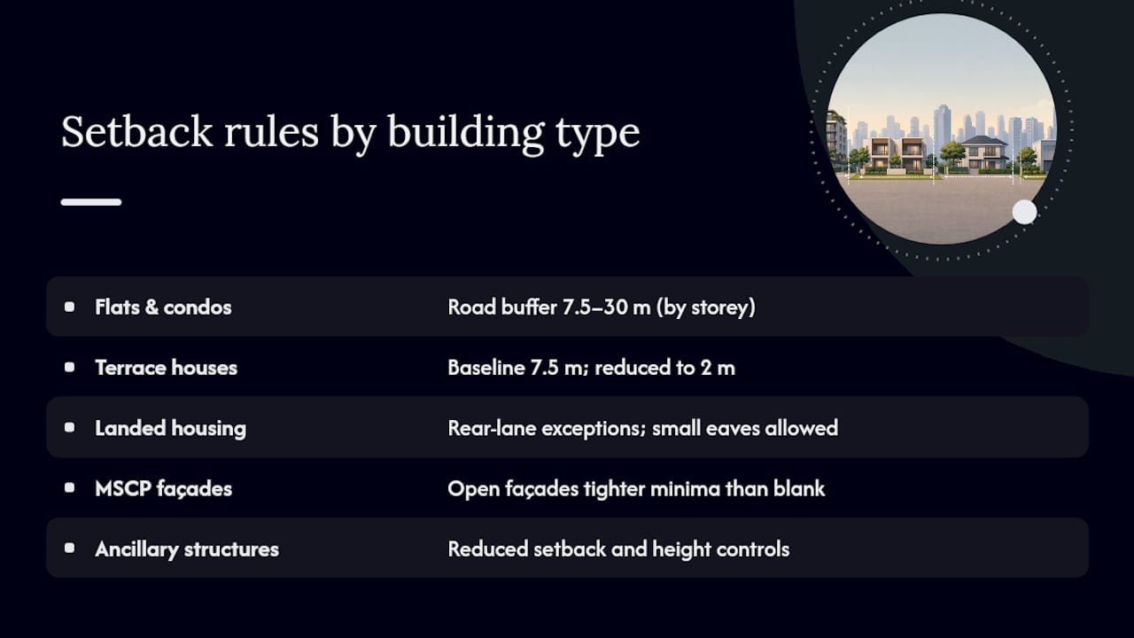
Flats and condominiums follow road buffer bands tied to both road category and storey height, running from 7.5m at the low end to 30m for tall schemes on major roads. Good Class Bungalow Area sites within this category carry their own stricter table, covered separately below.
Terrace and semi-detached houses generally work off a 7.5m baseline setback from the road, though reduced setbacks down to 2m can apply in specific estate contexts where URA has approved a lower figure for that street. Car porches attached to these houses often carry a depth caveat, commonly capped around 2.4m, to prevent the porch from functioning as an extra room that erodes the intended setback.
Landed housing on irregular lots sometimes qualifies for rear-garden or rear-lane exceptions, where the standard setback is relaxed because the rear boundary faces a service lane rather than another property. Roof eaves typically get a small allowed projection into the setback zone, but that allowance has a ceiling.
Multi-storey car parks (MSCP) follow a different logic entirely: façades with openings (for natural ventilation) face tighter setback minima than blank façades without openings, since URA weighs noise and headlight glare differently depending on whether the wall is porous.
Ancillary structures like meter rooms and guardhouses get their own reduced setback and height controls, since they are typically small, single-storey, and positioned at the property edge by function.
Appendage encroachments follow a consistent principle across all these types: bay windows, eaves, ledges, and planters can project into the setback zone, but only up to a defined limit and never far enough to compromise the road buffer’s ventilation intent. Check the façade design allowances against the specific setback figure for your site before finalizing elevations.
Do Good Class Bungalow Areas Have Stricter Setbacks?
Yes, and by a wide margin. Good Class Bungalow Areas (GCBAs) carry setback baselines well above standard landed housing, commonly starting around 25m for certain apartment-adjacent contexts, with an additional 1m added per storey above a defined height threshold. This overlay exists specifically to preserve the low-density, heavily landscaped character that defines GCBA estates.
Checking whether a site sits within a GCBA is a distinct step from checking road category. That confirmation comes from the URA Master Plan and its planning area maps, not from the road buffer tables alone. Missing a GCBA overlay is one of the more expensive mistakes in Singapore planning, since it usually surfaces only after a scheme has been drawn to standard setback figures and then rejected.
For redevelopment sites, the practical effect is a materially smaller building footprint than the plot size might suggest, which needs to shape massing decisions from the earliest concept sketch.
How Do PUB Drainage Reserves Affect Setback Planning?
Drainage reserves cannot be encroached upon, full stop, and that rule sits alongside, not underneath, whatever setback figure URA assigns to a site. PUB Services Plans, covering the Sewer Interpretation Plan (SIP), Drainage Interpretation Plan (DIP), and Water Services Plan (WSP), are the authoritative reference for where these reserves actually sit, and Qualified Persons need to pull them before finalizing any layout.
Structures that must cross a maintenance access route typically need to preserve horizontal and vertical clearances plus maintenance headroom, so PUB inspection vehicles and crews can still reach the drain. Where a site’s own drainage load requires detention or retention features to manage peak runoff, that infrastructure eats into usable site area, sometimes forcing a smaller building footprint even where the URA setback alone would have allowed more.
- Confirm drain and reserve alignments against the current DIP before the concept plan is finalized.
- Check whether the site’s Minimum Platform Level (MPL) interacts with the proposed ground floor level.
- Flag any maintenance access route crossing the site early, since retrofitting clearance later is costly.
Pro Tip: Order the PUB Services Plans before the architectural concept is locked, not after. Reserve boundaries have moved sites’ buildable envelope by meters on projects where the DIP was only pulled at submission stage.
What’s the Process for Confirming and Submitting Setback Compliance?
Confirming a site’s actual setback requirements takes more than reading a single URA table. It takes cross-referencing three or four separate agency documents, then verifying what those documents say against what is actually on the ground.
- Pull the current LTA Road Interpretation Plan to lock in the road category for every frontage.
- Obtain PUB’s SIP, DIP, and WSP through the PUB Services Plans portal to confirm drainage reserve and water main alignments.
- Check the URA Master Plan for zoning overlays, GCBA status, or planning area guidelines that might override standard tables.
- Verify invert levels and MPL on site, using trial holes where underground services are uncertain, rather than trusting the plans alone.
- Annotate submission drawings with justification notes for any reduced-setback request, cross-referencing drainage and MPL compliance directly on the plan.
Relying on desktop plans without a site verification step is a documented cause of submission failure, particularly where invert levels have shifted since the plan was last surveyed. Skipping the GCBA overlay check and omitting the peripheral planting verge from drawings round out the three most common, and most avoidable, causes of a rejected first submission.
Pro Tip: Build your submission checklist around the architecture approval process rather than a generic template. Setback justification notes get scrutinized far more closely than most other elements in a first review.
Which Laws and Agencies Govern Setback Requirements?
Setback control in Singapore sits within the Planning Act, administered by URA through its development control framework and published handbook tables covering every major development type. That framework does not operate alone, though. Drainage-related constraints fall under PUB’s remit through the Sewerage and Drainage Act, road-related buffers are cross-checked against LTA’s road categorization, and fire safety clearances tied to setback distances involve SCDF where applicable.
This multi-agency structure means a single setback figure on a URA table is rarely the final word. A road buffer that looks straightforward on paper can be narrowed in practice by a drainage reserve, widened by a GCBA overlay, or adjusted by a planning area guideline specific to that estate. URA’s development control handbooks function as the primary legal reference for the numbers themselves, while site-specific letters from URA, PUB, and LTA function as the binding confirmation for how those numbers apply to one particular plot.
Qualified Persons carry statutory responsibility for verifying which rules apply and certifying compliance on submission. That responsibility does not transfer to the applicant simply because a rule was misread or an overlay was missed. Building owners and developers commissioning a project should treat the QP’s setback verification as a legal safeguard, not a formality, given that a plan approved on an incorrect setback figure can be revoked or require costly rework once the discrepancy surfaces during construction or a later audit. The legal framework rewards early, documented verification and penalizes assumptions carried over from a previous project on a different street.
How Do You Get Setback Approval From URA and PUB?
Getting a setback confirmed and approved runs through a defined sequence, starting well before any formal submission lands on an agency’s desk. Most delays stem from teams treating this as a single-step check rather than the layered process it actually is.
The sequence generally starts with a pre-application check against URA’s published development control handbooks for the relevant property type, cross-referenced with the LTA Road Interpretation Plan to lock in road category. From there, a Qualified Person requests PUB’s Services Plans, since drainage reserve boundaries can constrain the buildable envelope independently of what URA’s table alone would allow.
Formal development application submission to URA follows, with drawings annotated to show the calculated setback, the source table row used, and any planning overlay (GCBA or otherwise) that applies to the site. Where a reduced setback is being requested, URA expects a written justification tied to the specific site conditions rather than a general appeal. PUB reviews the same submission in parallel where drainage reserves or detention infrastructure are involved, and any conflict between the two agencies’ requirements needs resolving before either grants approval.
Once URA grants provisional permission, the setback figures used in that approval become fixed reference points for every subsequent detailed design and structural submission. Changing them later, even slightly, typically triggers a fresh round of agency review. Building teams that treat the setback confirmation step as a formality rather than a gating decision are the ones who end up resubmitting drawings months into a project.
What Happens if a Building Violates Setback Rules?
Non-compliance with setback requirements carries consequences that extend well past a rejected drawing. URA can refuse or withhold planning permission outright when a submitted layout does not meet the applicable road buffer or common boundary figure, which halts a project at the earliest possible stage and forces a redesign before any construction cost is committed.
The more expensive failures happen later. A structure built to a setback that turns out to be incorrect, whether because a GCBA overlay was missed or a drainage reserve was encroached, can face enforcement action requiring demolition or alteration of the offending portion. That is a materially different cost profile than a delayed approval: it means rework on a completed structure, not a redrawn plan. Where a Qualified Person certified compliance on a submission that later proves incorrect, professional liability follows the QP directly, since certification of compliance is a statutory responsibility rather than a courtesy sign-off.
Encroachment into a PUB drainage reserve carries its own separate consequence path, since it can compromise flood mitigation for the wider area, not just the offending site. PUB treats reserve encroachment as a serious infrastructure risk, and remediation orders in that context tend to move faster and carry less negotiating room than a standard URA planning dispute. The safest position, and the cheapest one, is verifying every applicable setback figure against current agency plans before construction starts, not after a complaint or an inspection flags the discrepancy.
When Do Setback Rules Get Relaxed or Adjusted?
Setback figures are not always fixed at the table value. URA builds flexibility into the development control framework for specific planning contexts, and recognizing when that flexibility applies can materially change what a site can hold.
Conservation areas and identified urban design zones sometimes carry bespoke setback guidelines that override the standard tables entirely, reflecting a streetscape character URA wants preserved regardless of what a generic road category would otherwise dictate. Comprehensive development schemes and large integrated sites can likewise negotiate setback figures as part of a broader masterplan submission, where the overall scheme’s massing and public realm contribution factor into what URA will accept on individual boundaries.
Reduced setback approvals for terrace housing, mentioned earlier in the context of the 2m exception, are themselves a form of this variation: URA has, in specific estates, accepted a lower figure than the 7.5m baseline where the existing streetscape already reflects that tighter spacing. These exceptions are granted on a site-specific basis rather than as a blanket rule, which means a neighboring plot’s approved reduced setback is not automatically available to the next applicant on the same street.
Development control guidelines also shift over time as URA updates its handbooks, so a setback figure that applied to a comparable project five years ago is not a safe substitute for checking the current published table. Any variation request should be built around a clear planning rationale, not simply a reference to what a nearby building was permitted to do.
Publisher Perspective: Treating Setbacks as a Design Driver, Not a Compliance Afterthought
Setbacks work best as an early design input, not a late compliance check. Aectechnicalsg’s engineering teams integrate URA road buffer figures and PUB drainage checks at schematic stage, before massing decisions harden, because coordinating drainage and Minimum Platform Level verification early cuts approval cycles significantly compared with resolving conflicts after submission.
— Aman
Get Setback and Drainage Confirmed Before You Design, Not After
Where a generic checklist or a downloaded URA table leaves gaps, particularly around GCBA overlays, drainage reserve alignments, and reduced-setback justifications, Aectechnicalsg closes them by running URA, PUB, and LTA checks in parallel from the schematic stage, rather than discovering a conflict after drawings are locked.
Aectechnicalsg’s Qualified Persons handle the full coordination chain: confirming road category through the LTA Road Interpretation Plan, pulling PUB’s Services Plans to verify drainage reserve and MPL constraints, and preparing the annotated justification notes URA expects for any reduced-setback request. That coordination is what separates a submission that clears review once from one that bounces back for missing overlay checks or unverified invert levels.
If your project needs setback figures confirmed and authority submissions managed end to end, start with a review of your PE endorsement and authority submission needs to see what a coordinated submission package looks like for your site.
Where to Verify Current Setback Rules
Always cross-check figures against the live URA setback pages and PUB Services Plans, since tables are updated periodically.