
Geotechnical instrumentation is defined as the systematic use of sensors and measurement devices to monitor ground movement, soil pressure, pore water pressure, and environmental conditions in construction and infrastructure projects. The field spans multiple types of geotechnical instrumentation, from displacement sensors and vibrating wire piezometers to AI-driven data acquisition platforms. Standards such as JKR, GEO-HK, and JGS govern instrument selection and data validation across different jurisdictions. For engineering professionals and project managers, choosing the right ground movement instrumentation directly determines whether a project meets safety thresholds or faces regulatory intervention. This guide covers every major instrument category, selection criteria, and current technology developments.
1. What are the primary types of displacement and deformation sensors?
Displacement sensors form the backbone of any geotechnical monitoring program. They measure how soil, rock, or structural elements move over time, providing the earliest warning of instability in tunnels, retaining walls, and embankments.
Inclinometers are the most widely deployed displacement instruments on active construction sites. They measure lateral ground movement by tracking the angle of a casing installed vertically in a borehole. Modern systems use MEMS (Micro-Electro-Mechanical Systems) sensors, and high-density inclinometer strings with up to 200 sensor nodes spaced 0.6 meters apart now deliver high-resolution deformation profiles across an entire soil column. That level of resolution allows engineers to pinpoint the exact depth of a shear zone rather than estimating it from sparse readings.
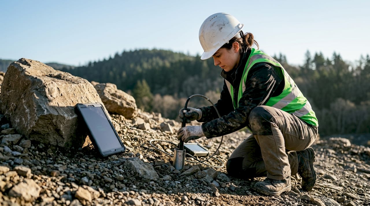
Horizontal in-place inclinometer (IPI) strings extend the same principle to horizontal monitoring beneath embankments and under tunnel bases. GEOSmart inclinometer systems use robust casing and closely spaced sensor joints to transmit data to processing software, which then triggers displacement alarms when thresholds are exceeded. This real-time alarm capability is what separates modern IPI systems from legacy manual survey methods.
Tiltmeters detect minor structural rotations, typically on retaining walls, bridge abutments, and building facades adjacent to excavations. They are sensitive to fractions of a milliradian and are most effective when paired with inclinometers to distinguish global ground movement from localized structural tilt.
Extensometers measure relative displacement between two fixed points. Rod extensometers anchor at depth and measure settlement or heave at the surface reference point. They are standard instruments in tunnel crown monitoring and deep foundation settlement assessment.
| Instrument | Measurement range | Typical resolution | Primary use case |
|---|---|---|---|
| Inclinometer (manual) | ±30° | 0.1 mm per 0.5 m | Retaining wall, slope |
| In-place inclinometer (IPI) | ±15° | 0.01 mm per node | Tunnel, embankment |
| Tiltmeter | ±5° to ±90° | 1 microradian | Structural tilt monitoring |
| Rod extensometer | 0–200 mm | 0.01 mm | Settlement, tunnel crown |
Pro Tip: Match the sensor to the expected movement direction. Inclinometers capture lateral shear; extensometers capture vertical settlement. Using the wrong instrument for the dominant movement type produces data that cannot be interpreted reliably.
2. Which sensors monitor stress, pressure, and pore water pressure?
Pressure monitoring instruments detect the forces acting on structural elements and the water pressure within soil pores. Both parameters are direct indicators of foundation and slope failure risk.
Vibrating wire load cells and piezometers remain industry standards for stress and pressure monitoring. Their frequency-based output is immune to cable resistance changes over long cable runs, which makes them reliable in the wet, corrosive conditions common on Singapore construction sites. Typical polling intervals are every minute, providing a continuous record of stress evolution during construction.
Earth pressure cells measure the contact stress between soil and a structural element such as a sheet pile, tunnel lining, or retaining wall face. They are embedded during construction and cannot be repositioned afterward, so placement planning is critical. A poorly positioned cell misses the peak stress zone and produces dangerously optimistic readings.
Piezometers monitor pore water pressure, the single most important early warning parameter for slope instability and foundation heave. Three main types are in common use:
- Vibrating wire piezometers: Fast response, high accuracy, compatible with automated data loggers. Best choice for real-time slope monitoring.
- Standpipe piezometers: Low cost, simple installation, but slow response time. Suitable for long-term groundwater level measurement in stable conditions.
- Pneumatic piezometers: Reliable in remote locations without power, but require manual reading or pneumatic tubing runs. Less suited to automated systems.
Vibrating wire load cells quantify the load applied to structures and soil interfaces, which is essential for verifying that design load assumptions hold during and after construction. When measured loads exceed design values, the data supports an immediate engineering review rather than a post-failure investigation.
For soil-structure interaction assessments, earth pressure cells and vibrating wire piezometers are typically deployed together. The combined dataset separates total stress from effective stress, which is the distinction that determines whether a retaining wall is safe or approaching failure.
3. How do vibration, seismic, and environmental sensors contribute to monitoring?
Static pressure and displacement readings describe what has already happened. Vibration and environmental sensors detect the conditions that cause failure before movement begins.
Geophones and accelerometers measure ground vibrations generated by blasting, pile driving, and heavy equipment. Geophones output velocity in mm/s and are calibrated against limits set by standards such as BS 7385 and DIN 4150. Accelerometers capture higher-frequency events and are preferred for seismic monitoring near critical infrastructure. Both instruments feed into vibration compliance reports required by authorities including Singapore’s LTA and BCA.
Seismographs record ground motion from natural seismic events. In Singapore, the primary seismic risk comes from distant Sumatra fault ruptures rather than local sources, but the instrumentation requirement is the same: continuous recording with triggered event capture.
Environmental sensors including soil moisture, temperature, conductivity, pH, and NPK sensors provide data on the conditions that govern soil strength and slope stability. Soil moisture content directly controls pore pressure generation during rainfall events. Temperature affects the behavior of expansive clays and frost-susceptible soils. These sensors are integral to comprehensive hazard analysis, not optional add-ons.
Key environmental sensor types used in geotechnical monitoring:
- Soil moisture sensors: Capacitance or TDR-based, installed at multiple depths to track wetting front migration during storms.
- Temperature sensors: Thermistors or thermocouples embedded in embankments and tunnel linings.
- Conductivity sensors: Detect leachate migration in landfill and contaminated site monitoring.
- pH sensors: Monitor chemical conditions affecting grout and concrete durability.
Pro Tip: Integrate rainfall data from a co-located rain gauge with piezometer and soil moisture readings. This three-parameter combination is the foundation of most published slope failure prediction models and makes your monitoring data defensible in a regulatory review.
4. What modern data acquisition systems support geotechnical instrumentation?
Sensors produce raw signals. Data acquisition (DAQ) systems convert those signals into engineering units, store the records, and trigger alarms when thresholds are breached. The DAQ platform is as critical as the sensor itself.
Static monitoring instruments poll at intervals greater than 1 second, while dynamic monitoring requires sub-second intervals to avoid aliasing errors. This distinction drives the choice between analog, vibrating wire, and digital sensor outputs. Analog and vibrating wire sensors respond immediately to a polling command. Digital outputs like SDI-12 support multiple instruments on a single cable but poll sequentially, introducing time delays that make them unsuitable for rapid hazard detection.
Universal DAQ platforms that support vibrating wire, analog, and digital protocols reduce operational complexity on large projects. A single logger handling all sensor types eliminates the need for multiple proprietary systems and simplifies data integration.
Cloud-based management systems add real-time alarm triggering via SMS and email when sensor readings cross predefined thresholds. AI-powered platforms like SlopeGuard+ update risk indicators every 2 hours by fusing physics-based models with multi-sensor data. That update frequency is fast enough to catch deteriorating conditions before they become emergencies.
| Feature | Static DAQ | Dynamic DAQ |
|---|---|---|
| Polling interval | >1 second | <1 second |
| Sensor protocol | VW, SDI-12, analog | Analog, accelerometer |
| Latency tolerance | High | Very low |
| Cloud integration | Standard | Requires low-latency link |
| Alarm triggering | Threshold-based | Event-triggered |
Effective AI-driven platforms integrate physics-based models with sensor data to produce safety verdicts that are scientifically and legally defensible in engineering reports. That defensibility matters when a project faces regulatory scrutiny or a post-incident review.
5. How to choose the right geotechnical monitoring tools for your project
Instrument selection starts with the monitoring objective, not the available budget. The objective defines the required measurement parameter, which then determines the sensor type, polling frequency, and data management approach.
Key decision factors for instrument selection:
- Measurement parameter: Displacement requires inclinometers or extensometers. Pore pressure requires piezometers. Stress requires load cells or earth pressure cells. Environmental conditions require soil moisture, temperature, or conductivity sensors.
- Required resolution and range: A tunnel crown extensometer needs 0.01 mm resolution over a 50 mm range. A slope inclinometer needs 1 mm resolution over a 200 mm range. Specify both before selecting a sensor.
- Polling frequency: Static applications (settlement monitoring, long-term groundwater) tolerate hourly readings. Dynamic applications (blast monitoring, seismic) require sub-second sampling.
- Data latency: Real-time alarm systems need data at the logger within seconds of measurement. Batch-upload systems are acceptable for trend monitoring but not for hazard response.
- Site conditions: Corrosive soils, high water tables, and remote locations without power all constrain sensor and logger choices.
- Regulatory requirements: Singapore authorities including LTA and BCA specify minimum monitoring frequencies and reporting formats for projects near MRT lines and critical infrastructure.
A typical tunnel monitoring configuration combines IPI strings for lateral movement, rod extensometers for crown settlement, vibrating wire piezometers for pore pressure, and geophones for construction vibration compliance. A slope monitoring configuration replaces the geophones with rain gauges and soil moisture sensors. The geotechnical investigation guide for Singapore developers provides site-specific configuration recommendations aligned with local authority requirements.
Common pitfalls include under-specifying sensor density, selecting digital protocols for dynamic applications, and failing to validate instrument performance against known reference points before construction begins. The geotechnical analysis guide from Aectechnicalsg outlines the validation steps required for compliant monitoring programs in Singapore.
Key Takeaways
The most effective geotechnical instrumentation program combines displacement, pressure, and environmental sensors with a DAQ platform matched to the required polling frequency and data latency of the monitoring objective.
| Point | Details |
|---|---|
| Displacement sensors lead most programs | Inclinometers and extensometers provide the earliest warning of ground movement in tunnels, slopes, and retaining walls. |
| Vibrating wire technology dominates pressure monitoring | VW piezometers and load cells offer reliable, frequent polling in corrosive and wet site conditions. |
| Environmental sensors improve prediction | Soil moisture and rainfall data combined with piezometer readings support defensible slope failure prediction models. |
| DAQ protocol determines monitoring speed | Analog and VW sensors suit dynamic applications; digital protocols like SDI-12 introduce latency unsuitable for rapid hazard detection. |
| Regulatory alignment is non-negotiable | Singapore authorities specify minimum monitoring frequencies and reporting formats that must be built into the instrumentation plan from the start. |
What I’ve learned after years of watching instrumentation programs fail
The most common failure in geotechnical instrumentation is not sensor malfunction. It is the mismatch between what the sensor measures and what the engineer actually needs to know. I have reviewed projects where inclinometers were installed to monitor vertical settlement, and extensometers were used where lateral shear was the dominant risk. The data was technically valid and completely useless for the actual hazard.
The second failure pattern is over-reliance on AI platforms without understanding the underlying physics. Tools like SlopeGuard+ are genuinely useful, but only when the input sensor network is correctly designed. A physics-based model fed bad sensor placement produces confident-looking outputs that are wrong. The platform does not know your site. You do.
The third issue is treating instrumentation as a compliance checkbox rather than a decision-support system. Monitoring data has value only when someone reads it, interprets it against the design assumptions, and acts on it. Automated alarms help, but they do not replace engineering judgment. The PLAXIS-based impact assessment workflow that Aectechnicalsg uses integrates instrumentation data directly into numerical models, which is the correct way to close the loop between field measurement and design verification.
My advice to project managers: define the trigger action response (TAR) plan before the first sensor goes in the ground. Know exactly what you will do when the alarm fires at 2:00 AM. That plan is more important than the sensor brand.
— Aman
Geotechnical instrumentation planning for Singapore projects
Engineering projects in Singapore operate under strict monitoring requirements from LTA, BCA, and other authorities. Getting the instrumentation plan right from the start avoids costly retrofits and regulatory delays during construction.

Aectechnicalsg provides engineering consultancy services covering geotechnical instrumentation planning, sensor selection, monitoring program design, and authority submission support. The team works directly with developers, contractors, and project managers to align instrumentation programs with BCA and LTA requirements. For projects requiring PE endorsement or authority submissions, Aectechnicalsg handles the full compliance and submission process so that monitoring data meets the evidentiary standards required by Singapore regulators. Contact Aectechnicalsg to discuss your project’s specific instrumentation requirements.
FAQ
What is geotechnical instrumentation?
Geotechnical instrumentation is the use of sensors and measurement systems to monitor ground movement, soil pressure, pore water pressure, and environmental conditions in construction and infrastructure projects. It provides the data engineers need to verify design assumptions and detect hazards before failure occurs.
What are the main types of geotechnical instrumentation?
The main categories are displacement sensors (inclinometers, extensometers, tiltmeters), pressure sensors (piezometers, earth pressure cells, load cells), vibration and seismic sensors (geophones, accelerometers), and environmental sensors (soil moisture, temperature, conductivity). Each category addresses a distinct failure mechanism.
How does groundwater level measurement work in geotechnical monitoring?
Groundwater level measurement uses standpipe piezometers or vibrating wire piezometers installed in boreholes. Standpipe types measure the static water level directly; vibrating wire types convert pore water pressure to a frequency signal that automated loggers record continuously.
What polling frequency do geotechnical sensors require?
Static monitoring applications such as settlement and groundwater trending tolerate polling intervals greater than 1 second. Dynamic applications such as blast vibration and seismic monitoring require sub-second sampling to comply with the Nyquist-Shannon theorem and avoid data aliasing errors.
Why do Singapore projects need specialized geotechnical monitoring programs?
Singapore’s dense urban environment places construction sites in close proximity to MRT tunnels, utilities, and existing buildings. LTA and BCA mandate specific monitoring frequencies, trigger action response plans, and reporting formats for projects within influence zones of critical infrastructure.